
Spokane County Block Sources
Each public source describes a different part of a Spokane County block. GIS establishes map context. SCOUT reports a parcel owner and tax-related fields. The Recorder connects land to deeds, liens, plats, easements, and covenants. Election data has a separate legal access route. Neighborhood councils identify civic areas and public meetings, not the residents of every home.
| Source | Block evidence | How to access it |
|---|---|---|
| County GIS parcel layer | Adjacent polygons, parcel numbers, streets and map context | Public map, ArcGIS layers and downloads; lines are advisory |
| SCOUT / Assessor | Owner, taxpayer and parcel details for one selected lot | Search each address or parcel separately; office and phone fallback |
| Recorder / Digital Archives | Deeds, plats, liens, easements and covenants tied to the block | Name, legal-description or document search; limited images; counter or mail copies |
| City and county permits | Address-keyed applications, dates and work types | City map and archive, county portal or counter |
| Neighborhood councils | Civic boundary, contacts, meetings and calendars | Official address finder and public council pages |
| Washington voter data | Authorized registration fields by address, precinct or district | SOS or county request, subject to use limits and ACP suppression |
| Polk reverse directories | Historic occupants by address from 1929 onward | Library and State Library collections |
The result is evidence about parcels and civic geography, not a complete list of nearby people. An owner's mailing address may belong to an agent or may be outside the county. The situs address names the physical parcel. A taxpayer address exists for billing. Keep all three apart, and never infer unseen household members from one owner's record.
Click Spokane County Parcels Nearby
The Spokane County GIS page leads to SCOUT, maps, downloads, and shapefiles. Public MapSpokane layers include streets, addresses, permits, parcels, municipal boundaries, neighborhood councils, schools, water-service areas, and parcel numbers. Start with one known address, locate its polygon, then inspect the polygons that share a boundary or sit across the street.
The research did not confirm the names of any radius, buffer, or select buttons in the current interface. Use visible map browse or geometry controls and avoid promising a feature that may have moved. After reading a neighboring parcel number, open that parcel in SCOUT as its own official record. This two-step method is slower than a commercial map, but it keeps the source and confidence level clear.
View Spokane County's official GIS access page before tracing nearby lots.
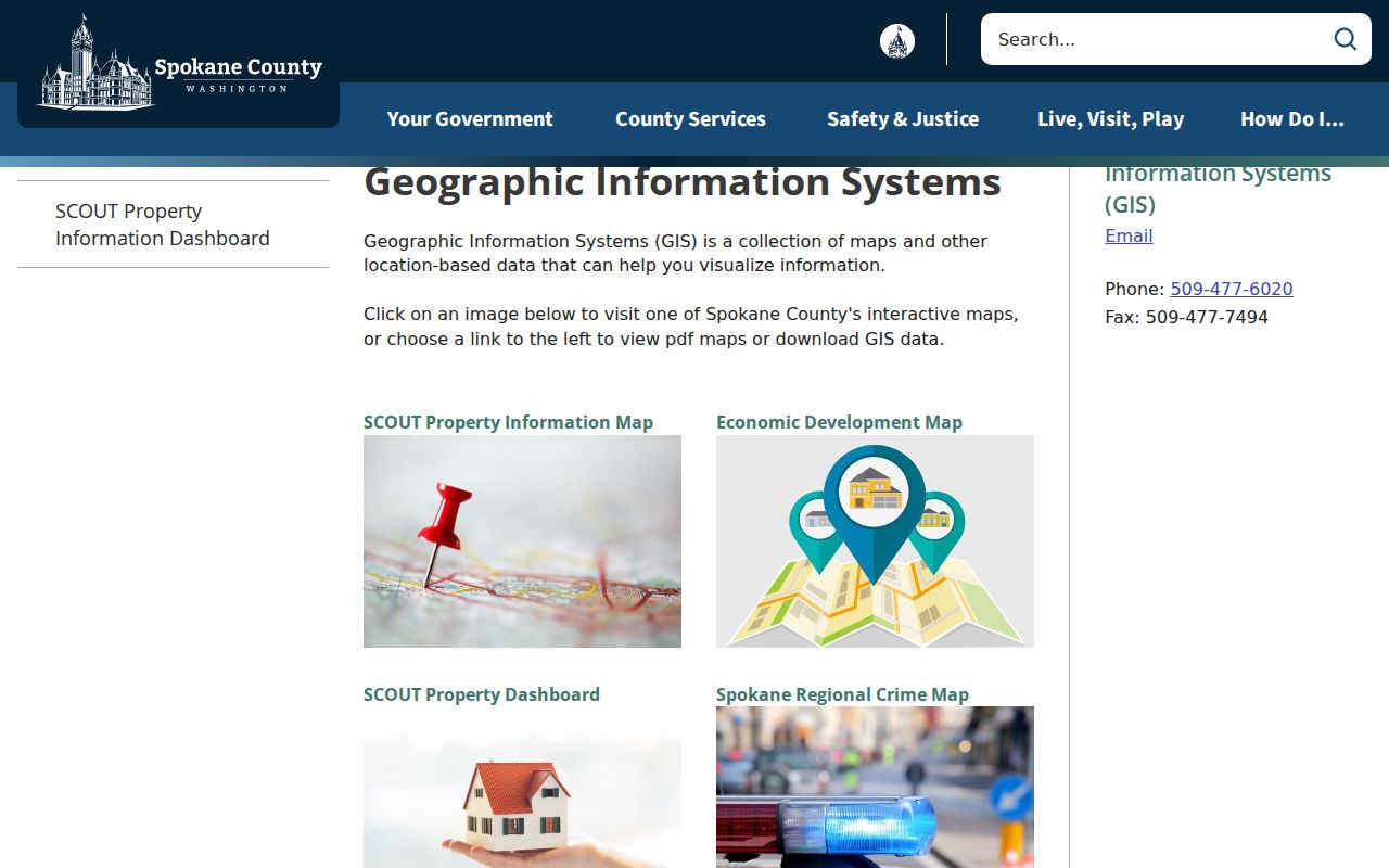
The captured page points to county-maintained tools. Its map access supports block context, while the separate assessor record supplies the parcel details.
Note: County parcel lines are advisory; use a surveyor when the actual legal boundary matters.
Map Spokane County Neighbors
A careful block lookup moves from land to records, one parcel at a time. It does not begin with a guessed surname. Normalize the house number, street direction, street type, unit, postal code, and municipality before opening the map.
- Search the address in the SCOUT Dashboard. Copy the parcel number exactly, including its punctuation.
- Open the GIS parcel and browse the lots beside it and across the road. Record each surrounding parcel number.
- Search every parcel separately in SCOUT. Keep owner, owner mailing address, taxpayer address, and situs address in separate columns.
- Use the Recorder only when a deed, plat, easement, lien, or covenant answers the block question. An instrument is not proof of current occupancy.
- For an entire road rather than the immediate block, switch to the Spokane County street directory.
The process produces a parcel-by-parcel research sheet. Add the source date to every row. If SCOUT fails, the county Property Information Search page, Assessor office, GIS staff, and public-record request process are valid fallbacks. Recorded images hidden online because they contain personal identifiers can be requested through the Auditor's Recording Department, subject to redaction and copy rules.
Spokane Neighbors and Councils
The City of Spokane recognizes 29 independent neighborhood councils across three districts. Their pages provide boundaries, contacts, meetings, calendars, and an address finder. Meetings are open to people age 16 or older who reside, run a business, or own property in the council area. That eligibility rule supports civic participation. It does not create a public membership roster or establish where any named person lives.
| District | Council areas | What the directory offers |
|---|---|---|
| 1 | Bemiss, Chief Garry Park, Hillyard, Logan, Minnehaha, Nevada Heights, Riverside, Shiloh Hills, Whitman | Public contact and meeting pages; no resident roster located |
| 2 | Cliff/Cannon, Comstock, East Central, Grandview/Thorpe, Latah/Hangman, Lincoln Heights, Manito/Cannon Hill, Rockwood, Southgate, West Hills | Address finder and civic participation details |
| 3 | Audubon-Downriver, Balboa/South Indian Trail, Browne's Addition, Emerson/Garfield, Five Mile Prairie, North Hill, North Indian Trail, Northwest, Peaceful Valley, West Central | Boundary, calendar and contact information |
| County areas | HOA and subdivision document trails | Covenants, plats and declarations through county and Recorder sources, not membership lists |
Use the official neighborhood council inventory for current contacts. The GIS Neighborhood Council layer can locate a polygon by name or geometry. Keep the map's version and date because a historical neighborhood label may not match a current council boundary.
Separate Spokane County Block Layers
Neighborhood, ZIP, precinct, parcel, city boundary, school area, water-service area, and HOA are separate overlays. The difference is especially important near Spokane Valley, Liberty Lake, Airway Heights, and unincorporated county edges. A postal city can cross a city line. A council area is civic, while an HOA declaration is a recorded property document. A precinct organizes voting, and a parcel records a piece of land.
This geography is the page's main interest layer. For each Spokane County address, write down the label from every official system and its date. Do not fuse them into one “neighborhood” field. A conflict often means that two systems answer different questions, not that one record is wrong.
- Parcel
- A separately identified piece of land in the assessor and GIS systems.
- Situs address
- The physical address assigned to the parcel, distinct from an owner's mailing address.
- Precinct
- An election geography used to organize voters and ballots.
- Covenant
- A recorded rule or restriction tied to land, not a current list of residents.
Spokane Neighbors in Voter Data
Washington permits access to selected voter-file fields through the Secretary of State extract and Spokane County Elections request. Public fields can include name, residential and mailing addresses, jurisdiction, precinct, gender, year of birth, registration date and number, and participation history. Full birth dates, driver-license data, Social Security digits, and ballot choices are not public. Washington does not register voters by party.
The county form allows a full-county or single-district request and up to five elections of voting history. The electronic list fee is $20, and a matchback costs $35 per election. A requester must certify the authorized purpose. RCW 29A.08.720 and .740 restrict use, while the Address Confidentiality Program shields protected addresses. VoteWA is a personal sign-in portal, not a public bulk neighbor search.
For missing historical poll books or registers, try the State Archives Eastern Regional Branch in Cheney, Spokane Public Library collections, the county archive, or an election public-record request. No named, complete online Spokane County series was found. A no-result may reflect protection, archive placement, or a different geography rather than absence from the community.
Spokane County Street Activity
Permits add block context without naming every neighbor. The City of Spokane permit activity map covers up to three years, updates nightly, and filters by address, application type, status, date, district, neighborhood, and keyword. Pre-1993 city permits use the city archive; later regular permits use the current portal. Spokane County holdings reach to about 1930, though pre-1970 material can be incomplete.
A permit can date an application or regulated project. It does not prove that work finished or that the applicant lived at the address. The same caution applies to covenants, declarations, plats, and Recorder instruments. These records explain how the block developed, which lots share restrictions, and why boundaries appear as they do. They are not a current directory of local residents.
Note: Date permit-map results because the city view is recent and refreshed each night.
Official Spokane Neighbor Records
Commercial neighbor tools often blend stale addresses, household guesses, and copied public indexes. Their display may hide where a name came from or when it was last checked. Official records are narrower but make the custodian and meaning clearer. Use them to verify a parcel, deed, precinct, permit, or civic boundary, then retain the source date.
| Question | Official source | Commercial category limit |
|---|---|---|
| Which lots are nearby? | County GIS parcel layer | Map may not show its boundary source or revision |
| Who owns a parcel? | SCOUT / Assessor | May confuse owner with occupant |
| Which civic area applies? | City council map and county GIS | May merge ZIP, city and neighborhood labels |
| What document affects the lot? | Recorder index and requested copy | May omit the instrument or current status |
When accuracy matters, ask the custodian for the record rather than relying on an unlabeled compilation. Washington's Public Records Act requires a request specific enough for the agency to locate responsive material. A parcel number, instrument number, date range, and office name make a block request far more useful than a request for every record about the block.
Limits on Spokane County Neighbors
No official roll lists every renter, child, household member, utility customer, or delivery recipient on a Spokane County block. DMV addresses are restricted. Vital records, jail information, juvenile matters, sealed court files, protected voter records, and personal identifiers can be withheld or redacted. Recorder images containing certain identifiers may be unavailable online even when the document index remains searchable.
Washington's Address Confidentiality Program provides a substitute address and mail forwarding to eligible people facing serious safety risks. Protected registration is suppressed from ordinary voter access. Never try to reverse a substitute address or publish a hidden location. An assessor or voter no-result does not justify searching for a protected person elsewhere.
Lawful use. Research Spokane County neighbors for civic awareness, family history, property questions, or safe reconnection. Never use public data for unwanted contact, surveillance, threats, harassment, or harm.
Public access is not permission to monitor someone. RCW 9A.46.110 addresses repeated harassment, following, contact, or monitoring that causes fear or substantial distress. Keep only the fields needed for a legitimate task, redact private details from screenshots, and route corrections to the office that maintains the source record.