
Spokane County ZIP Coverage
The county's official ZIP and precinct map supplies the strongest local crosswalk. It was produced March 31, 2026, is effective for March 2026, and warns that its geography is revised often. The labels below are place associations from that map, not promises by the Postal Service. A postal route can cross a municipal line, and a place name printed with a ZIP may describe mail delivery rather than local government.
| ZIP | County-map area | Delivery label | Search caution |
|---|---|---|---|
| 99001 | West Plains | Airway Heights | Verify the exact address. |
| 99004 | Southwest county | Cheney | Do not treat the label as the city line. |
| 99006 | North county | Deer Park | Confirm rural delivery by address. |
| 99011 | West Plains installation | Fairchild AFB | Installation delivery rules may apply. |
| 99016 | East county | Greenacres | Compare with Spokane Valley boundaries. |
| 99019 | East county | Liberty Lake | Confirm jurisdiction in GIS. |
| 99022 | West county | Medical Lake | Verify the physical address. |
| 99026 | Northwest county | Nine Mile Falls | Delivery and county geography may differ. |
| 99037 | Spokane Valley area | Veradale / Spokane Valley | Check the municipal boundary. |
| 99201-99208 | Spokane core and neighborhoods | Spokane | Use the full code for a local search. |
| 99212, 99216-99218 | East and north Spokane areas | Spokane area | Some routes extend beyond Spokane city. |
| 99223 | South Spokane area | Spokane | Verify municipal status. |
| 99224 | West Plains and airport area | Spokane area | Includes unincorporated locations. |
The complete county-map list also associates codes with Chattaroy, Colbert, Elk, Fairfield, Four Lakes, Latah, Marshall, Mead, Mica, Newman Lake, Otis Orchards, Rockford, Spangle, Valleyford, and Waverly. Several 99013 through 99038 labels have no delivery city confirmed in the research. Use the map to identify the candidate code, then use the Postal Service to settle the delivery address. This Spokane County ZIP code directory does not guess at missing post-office assignments.
Codes on the map that still need an address-level postal check include 99013, 99015, 99017, 99024, 99028, 99029, 99032, 99033, 99034, 99035, and 99038. The county PDF also shows neighboring codes beyond the verified Spokane County list because its map extent crosses the county edge. Do not add those outer labels to a Spokane County result based on the picture alone. Match the point to the county boundary, verify the complete address through USPS, and preserve the map's effective month. That three-source check prevents a nearby delivery code from being mistaken for a Spokane County address.
Five Spokane County Map Layers
A ZIP is delivery geography. Spokane County records use at least five other ways to describe the same point: postal city, municipal boundary, precinct, parcel, and neighborhood council. School and water-service areas add more layers. They answer different questions. A parcel identifies land for assessment, a precinct organizes elections, and a council boundary supports civic participation. None alone proves where a named person now lives.
The Spokane County GIS page links the SCOUT map and downloadable data. MapSpokane exposes address, parcel, parcel-number, street, permit, municipal-boundary, neighborhood-council, school, and water-service layers. Preserve the layer date when comparing them. Parcel lines are advisory, so a legal boundary dispute needs a surveyor rather than a screen measurement.
Note: A current layer date matters because postal, precinct, and council boundaries can change on different schedules.
Verify Spokane County ZIP Codes
The USPS ZIP Code Lookup is the final authority for the delivery code attached to a full mailing address. It offers address-based, city-and-state, and ZIP-based lookup routes. Use the whole address when possible. A city-and-state query can return many codes, while a code query tells you its postal label but does not decide whether the point lies in Spokane, Spokane Valley, or unincorporated Spokane County.
Open the USPS lookup controls to confirm a mailing code before consulting the local rolls.
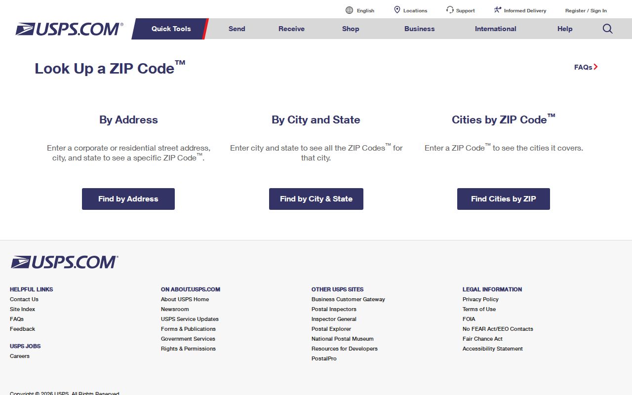
The source screen anchors the postal part of the workflow. County GIS then supplies the separate parcel and jurisdiction context.
Search Spokane County by ZIP
No official portal in the research offers a complete household list by ZIP. SCOUT visibly accepts a parcel number or address, not a confirmed postal-code filter. GIS data can be filtered by location, while election extracts are requested for the full county or a single district rather than through a public ZIP field. The sound method is therefore to use a ZIP to define an area, then check each official record on its own terms.
- Confirm the complete address and delivery code through USPS. Record the returned postal city exactly.
- Enter the address in the SCOUT Dashboard. Save its parcel number, situs address, and owner information as separate fields.
- Open the parcel in county GIS. Compare municipal, precinct, street, and neighborhood layers without merging them.
- Use an authorized county or state voter-data request only when registration geography is needed. Account for protected voters and statutory limits.
- Once the work narrows to one road, use the Spokane County street directory for the address-level chain.
An assessor owner is not necessarily an occupant. The situs address is the physical parcel, while the owner's mailing address and the Treasurer's taxpayer address can lead somewhere else. Preserve those distinctions. A ZIP-wide search result, even if built from mapped parcels, remains a set of property records rather than a roll of all Spokane County residents.
Spokane County ZIP Search Fields
The confirmed controls explain what can and cannot be searched directly. They also show why the Spokane County ZIP code directory is a narrowing tool, not a replacement for the source records.
| Official source | Confirmed input | ZIP behavior | Best use |
|---|---|---|---|
| USPS lookup | Address; city/state; ZIP | Dedicated postal lookup | Confirm delivery identity |
| SCOUT | Parcel or address | No official ZIP filter captured | Open one parcel record |
| County GIS | Map browse, parcel and address layers | Spatial comparison through map data | Compare local boundaries |
| SOS voter extract | County/data file and requester agreement | No public ZIP input documented | Lawful registration research |
| County election form | Full county or single district | Precinct and district fields available | Request an authorized extract |
When a public interface lacks the needed filter, contact the custodian rather than inventing a query. County Elections handles its form and map corrections. GIS provides map and data access. The Assessor can address a parcel question by office or phone if SCOUT fails. A narrow request that names an address, district, parcel, and date is easier to locate than a demand for every person in a postal zone.
ZIP Codes and Spokane Voters
Washington voter files contain selected public fields, including name, residential address, jurisdiction, precinct, year of birth, registration date and number, and participation history. Ballot choices are never shown, and Washington does not register voters by party. The personalized VoteWA portal is not a bulk name search. A state extract or Spokane County Elections request is the documented channel for broader data.
The county request form allows a full-county or single-district list and offers address, precinct, jurisdiction, and several registration fields. It does not expose a ZIP option in the captured form. Electronic lists cost $20, and matchbacks cost $35 per election. Requests must meet the certified lawful-use rules in RCW 29A.08.720 and .740. Protected-voter and Address Confidentiality Program records are suppressed.
Keep overlays separate. A voter precinct and ZIP can overlap, but neither proves a municipal boundary or reveals a ballot choice.
Date Spokane County ZIP Maps
The March 2026 map is a timely snapshot. Its own warning says the map is constantly revised, so every research note should include the effective month and source URL. If a postal result conflicts with the county layer, record both and ask the agency responsible for the disputed field. USPS controls delivery codes, County Elections maintains the ZIP-and-precinct crosswalk, and local GIS clarifies parcel and municipal context.
Spokane County spans about 1,756 square miles, up to 54 miles north to south and 36 miles east to west. That scale explains why one postal label can be a poor stand-in for the whole local geography. Places such as Mead, Colbert, Mica, Latah, Valleyford, and Nine Mile Falls can appear in county research even when a searcher first types only “Spokane.”
Note: Save the effective date with each Spokane County ZIP code result so later boundary changes can be explained.
Spokane ZIPs Versus City Limits
The common myth is that a ZIP proves the city boundary. It does not. Codes associated with Spokane Valley, Liberty Lake, Airway Heights, and West Plains show why. The 99224 area includes airport-area and unincorporated locations. The 99037 and 99206 areas need a separate Spokane Valley boundary check. A 99026 Nine Mile Falls label identifies delivery geography, not one municipal government.
For a dependable Spokane County ZIP code directory result, keep four values: full USPS address, county parcel number, municipal status, and source date. If an old directory or permit uses a different street address, search the legal description and parcel history. No dated countywide readdressing rule was found, so changed addresses should be confirmed through permit, parcel, city GIS, county GIS, and archived directory evidence.
- ZIP code
- A Postal Service delivery area. It is not a municipal boundary.
- ZIP+4
- The base code plus four digits that narrow delivery to a smaller segment.
- PO-box ZIP
- A code used for post-office boxes rather than a mapped set of homes.
- Unique ZIP
- A code assigned to one high-volume organization or installation.
- Carrier route
- The delivery path served by a postal carrier, which can cut across other local boundaries.
This vocabulary keeps a postal code from being overread. It also makes the handoff from ZIP geography to parcel, street, or precinct research clear.