
Walk a Spokane County Street
Start with one verified address, not a person's name. Spokane County uses separate systems for the Assessor, GIS, Auditor/Recording, permits, and elections. A match in one is a lead to the next. It is not proof that every named person lives there now. The strongest street-by-street method preserves the parcel number, legal description, instrument number, and date at each stop.
- Normalize the house number, directional, street type, unit, ZIP, and municipality. Confirm the delivery form with USPS when needed.
- Enter the parcel or address in the SCOUT Dashboard. Record the situs address, parcel number, owner, and owner mailing address as distinct fields.
- Open the county GIS route. Browse parcels along the same street and note the map layer date.
- Use the owner, legal description, or instrument number in the Recorded Document Search. A seller appears as grantor and a buyer as grantee.
- Check lawful voter data, permits, and a 1929-or-later Polk reverse directory only for the narrower fact each source can support.
This flow keeps ownership, tax mailing, and occupancy from being blended. For one named person rather than a whole road, the Spokane County resident lookup uses a different verification path.
SCOUT Starts the Street Directory
The Assessor's SCOUT Dashboard is the most direct public start for a current parcel. Its visible control accepts either a parcel number or an address. County property information can include ownership, sales, legal description, taxes, photographs, and building characteristics, although the full live parcel-card labels were not available in the research capture. Do not claim a ZIP-wide or owner-name search control unless it is visible during the visit.
| SCOUT control | Kind | Use |
|---|---|---|
| Parcel or address | Text field | Enter a known parcel key or normalized site address |
| Search | Button | Runs the parcel lookup |
| Owner-name control | Not confirmed | Do not assume it is available |
| ZIP filter | Not confirmed | Do not present it as a street-wide tool |
The official SCOUT search is shown below. The capture identifies the correct county portal and its parcel-or-address entry point.
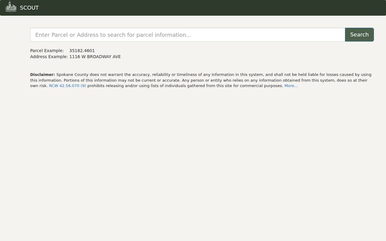
Once a parcel opens, save its number. That stable key is often more useful than a spelling-sensitive street name.
Spokane County Records by Address
No single Spokane County street directory contains all households. Each address-keyed source answers a narrower question and has its own fallback when a website cannot return the needed record.
| Address source | Custodian | What it supports | Access route |
|---|---|---|---|
| Property roll | County Assessor | Parcel, owner, situs, mailing address, value, sales, legal description | SCOUT; office or phone |
| Tax record | County Treasurer | Taxpayer mailing and billing facts | Property links; office at 509-477-4713 |
| Deed index | County Auditor | Grantor, grantee, date, type, instrument, related land facts | Online index; counter, phone, or mail for copies |
| Parcel map | County GIS | Parcel shapes, address, street, permit, and civic layers | Interactive map, REST layers, downloads |
| Permit files | City or county | Project address, date, work, applicant or contractor | City archive/portal; county portal or counter |
| Reverse directory | Public and State libraries | Historical occupant listed under an address | 1929-or-later volumes; library access |
| Voter extract | County Elections or SOS | Lawful public registration fields | Personal VoteWA access or regulated request |
A permit applicant is not proof of occupancy. A taxpayer may differ from the owner, and an owner's mail may go elsewhere. A useful by-address result therefore retains the source date and custodian beside every name.
Access also changes with the record. SCOUT and the GIS viewer provide a current online start, but the Treasurer and Assessor remain available by office or phone when a parcel result needs explanation. Recording combines a free index with public-computer access and copy service. Elections data requires the proper county or state request route and the certifications imposed by Washington law. Polk directories may require an on-site library volume, while older county records can lead to the archive in Cheney. A complete Spokane County street search records these fallback channels before concluding that no source exists.
Map Spokane County Street Parcels
Spokane County GIS adds the spatial view that a text index lacks. The public MapSpokane service contains address, permit, parcel, parcel-number, street, municipal-boundary, neighborhood-council, school, and water-service layers. Click or query each parcel on a road, then follow its number into SCOUT. This turns a street into a group of official parcel searches rather than an unsupported list of people.
The Spokane County GIS page gathers the map, SCOUT, downloads, and public-use notes. Its captured screen helps distinguish the county mapping route from an unofficial map.
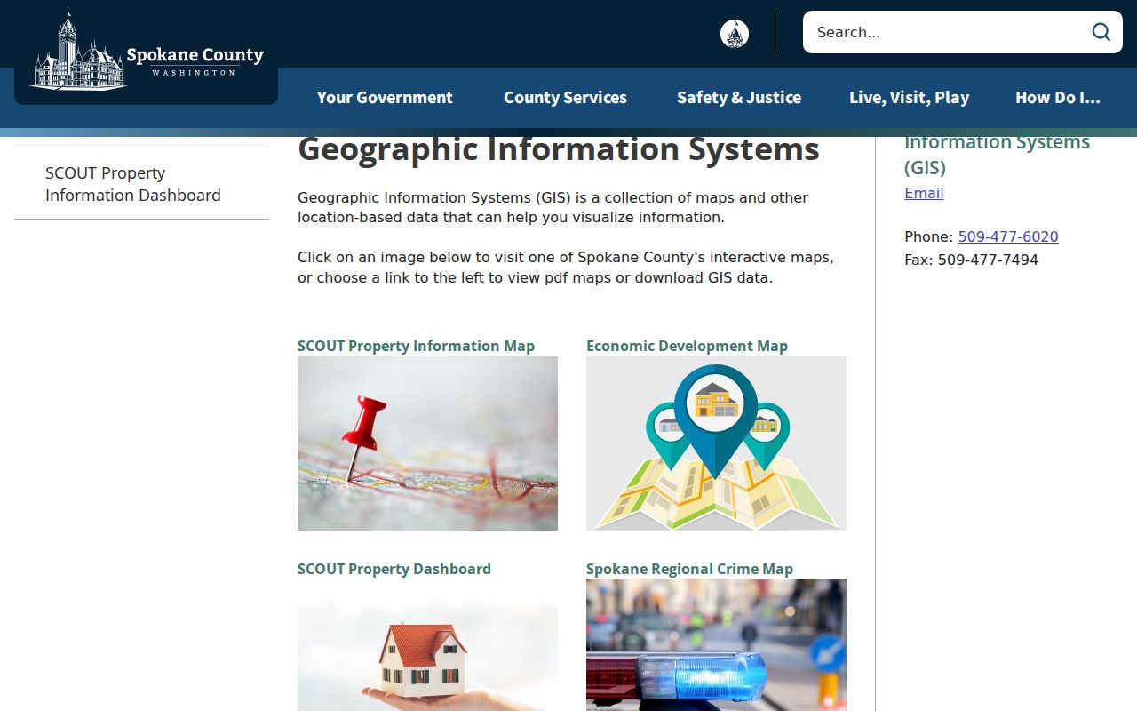
Parcel lines in the viewer are advisory. A legal boundary issue belongs with a licensed surveyor and the recorded plat or survey, not a screen trace.
Geography check. ZIP, postal city, municipality, precinct, neighborhood, and parcel are separate Spokane County overlays; label each one by source.
Read Spokane Street Record Terms
Three short terms prevent major mistakes in a street directory search. They connect the map, tax roll, and recorded document without treating them as the same record.
- Parcel
- A mapped unit of land with its own county identifier. A street address may cover one parcel or more than one.
- Situs address
- The physical location assigned to the parcel. It is not the owner's mailing address or the Treasurer's taxpayer address.
- Plat
- A recorded map that divides land into lots, blocks, roads, or other features.
- Criss-cross directory
- A directory arranged by street address, allowing a historical occupant to be found from the place rather than the name.
In Spokane records, an “addition” may name a subdivision. Lot-and-block shorthand, such as an entry beginning with a lot and block, can survive even when the street number changes.
Follow Spokane County Street Deeds
The Recorder index turns a current owner into a dated transfer trail. Search Grantor, Grantee, or both; narrow by document number, document type, and date range. Exact search expects last name first, while advanced matching ignores word order. When an instrument number is already known, use it before a broad surname. This is the street directory's best defense against common-name matches.
The Spokane County Recorded Document Search screenshot shows the official index entry point.
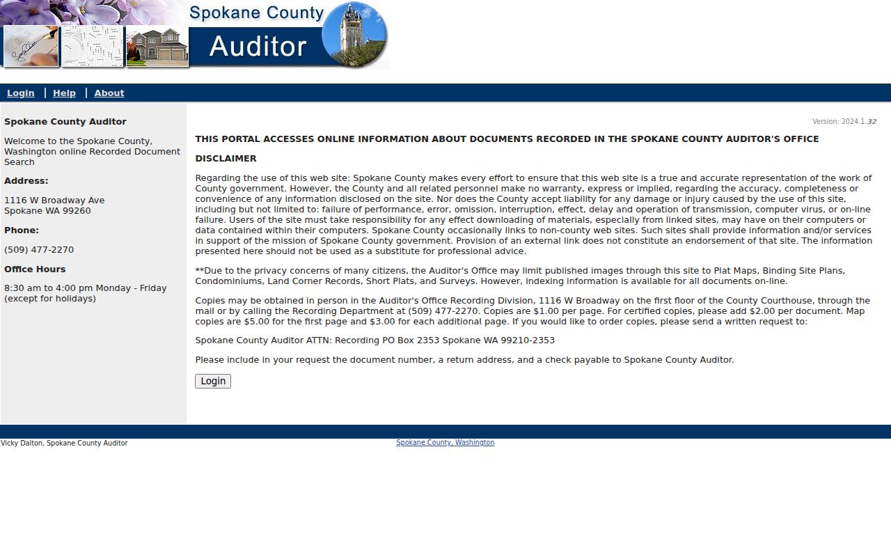
The index is free, yet many deed and deed-of-trust images are withheld online because they can contain personal identifiers. Plats, surveys, maps, condominiums, and related map records are more often viewable. The index result is still a finding aid, not a certified copy.
Work from the most specific key available. The Recorder form supports Grantor, Grantee, combined party searching, document number, document type, and start and end dates. Entering the same start and end date limits the search to one day. The Search All Types control can be narrowed to several document types. If a street parcel shows a recent sale, its date and owner often make a focused query more reliable than a countywide surname search. Save the instrument number, recording date, party role, document code, legal description or parcel reference, related instrument, and image status. Those fields make the next transfer easier to find and show exactly which facts came from the index.
The county's Recorder Search Help documents exact and advanced matching.
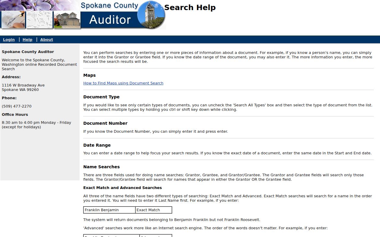
The help screen is useful when a name order, one-day date search, or multi-type selection produces an unexpected result.
Offline Spokane Street Records
When an image is missing, use the custodian's other channels. The Spokane County Auditor/Recording counter is at 1116 W Broadway Avenue in Spokane and operates Monday through Friday, 8:30 a.m. to 4 p.m. Copies may be ordered in person, by phone at 509-477-2270, or by mail to Spokane County Auditor ATTN Recording, PO Box 2353, Spokane, WA 99210-2353. Posted recording copies are $1 per page, with certification adding $2 per document; maps cost $5 for the first page and $3 for each added page.
Digital Archives supplies a second index route. Its Spokane land series covers 1960 through 2026, while plats and surveys reach 1880 through 2026. Earlier deeds require the counter, deed books, the County Archive Center, the Eastern Regional Branch in Cheney, FamilySearch, or library material. The research found no official earlier deed-book cutoff, so a street search should not invent one.
The County Archive Center offers its own searchable path with keywords, an Archive selector, a time period, and start and end dates. Property Tax & Assessments is one relevant archive label. For regional historical material, the Washington State Archives Eastern Regional Branch is at 960 Washington Street in Cheney. It accepts research appointments Wednesday through Friday and can be reached at 509-235-7500 or eabrancharchives@sos.wa.gov. Keep the source's municipality with the result because Spokane city, Spokane Valley, Cheney, Airway Heights, Medical Lake, Deer Park, Liberty Lake, and unincorporated places can all occur in Spokane County records.
Note: Current-year archive coverage can be incomplete, and online image availability varies by document type.
Spokane Streets Through Permits
Permit files can date construction, an addition, a demolition, or a change in use. Spokane city records split around 1993: the city archive handles earlier material, while the regular portal handles later permits. The public permit map shows up to three years and updates nightly. County Building & Planning records reach back to about 1930, though pre-1970 gaps may occur.
Search the project address, then keep the permit date and work type beside any applicant or contractor. Those names identify roles in the project, not the people living at the address. City Clerk records from 2004 also allow keyword, file, department, type, and date searches. Older or missing county material can be requested through the counter at 1026 W Broadway or the county archive labels.
A permit trail is strongest when paired with SCOUT sales, a deed instrument, and a dated directory entry. It can explain when a building changed even if it cannot name every occupant.
Historic Spokane Streets by Address
For older occupants, the street directory shifts from current parcels to Polk volumes. Address lookup becomes practical in Spokane beginning in 1929. Start with the street and number in a 1929-or-later reverse volume, take the listed occupant's name, then move into earlier alphabetical directories. The complete collection and publisher runs belong to the Spokane County city directory resource.
Sanborn fire-insurance maps cover Spokane from 1884 through 1952 with periodic updates. They add building footprints and use context, but they are not resident lists. Census schedules become public under the 72-year rule and can confirm a household near a directory year. Search “Spokane Falls” as well as “Spokane” in nineteenth-century material, since the Digital Archives directory naming changes across those labels.
County boundaries also shifted after Spokane County's creation in 1858, reorganization, recreation in 1879, and 1883 boundary changes. A historic county label may cover a place outside today's border.
Limits of Spokane Street Directories
A public street search cannot produce a complete current household list. Renters and other household members are not indexed in one open Spokane County source. Utility customer and delivery records are private. Motor-vehicle addresses are restricted, and protected voter addresses may be hidden through Washington's Address Confidentiality Program. No ballot choice is public.
Owner, taxpayer, and occupant must remain separate. Likewise, a homestead indicator may support an occupancy clue but cannot prove who is present today. A failed search can reflect spelling, timing, a sealed record, suppression, an unrecorded change, or the wrong custodian.
Lawful use. Use Spokane County address records for family history, property research, civic curiosity, or scam checks. Never use them to stalk, harass, threaten, or harm anyone.
Confirm an important fact with the office that holds it. Record the lookup date, since maps, parcel rolls, permits, voter files, and index coverage change.